How rivers flow and why it floods
24 August 2026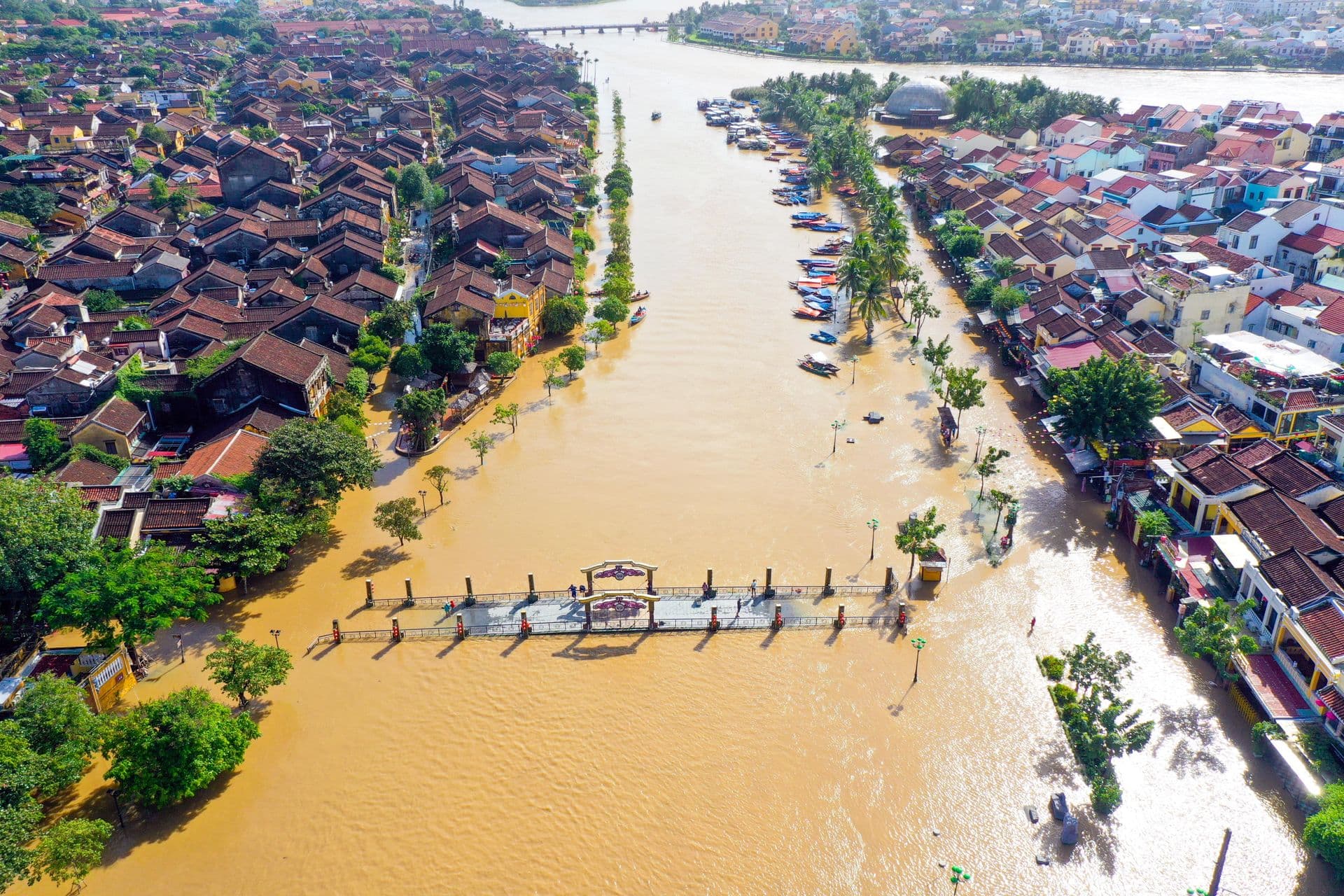
There is a particular kind of quiet that settles over a river on an ordinary day. Water slides past reeds, curls around a fallen branch, catches the light in a hundred small disagreements with itself. It looks settled, almost bored. And yet everything about that motion is a negotiation — between gravity pulling water downhill and friction dragging against every grain of sand, every rock, every bend the channel has carved over centuries. A river is never really at rest. It is an argument that has found a temporary truce.
That truce is what engineers call steady, uniform flow — a state where the water's speed and depth stay roughly constant in space (uniform) and in time (steady), because the pull of gravity down the slope is exactly balanced by the resistance of the riverbed. Slope drives the water forward; roughness holds it back. A gravel bed clawing at the current behaves differently from smooth silt, which is why two rivers with the same slope can carry water at very different speeds. Hydraulic engineers describe this balance with equations bearing names like Manning or Chézy, but the intuition predates the mathematics by millennia: anyone who has watched water pick up speed on a steep, smooth chute and slow to a crawl over a stony ford already understands the principle in their hands and feet, if not in symbols (but we shall talk about those equations too in coming times since it may not be ideal to leave all understanding up to intuition).
Anyway, rivers are rarely so polite as to stay steady. Rain falls unevenly, snow melts in pulses, tributaries join at odd angles — and the truce breaks. This is where the story turns from a walk beside the water to something closer to bookkeeping. At any cross-section of a channel, the amount of water passing through per second — the discharge — is simply the cross-sectional area of the flow multiplied by its average velocity. When more water arrives than the channel can pass through at its current depth, the only way to accommodate it is for the depth to rise. Now, as much as one may love the idea or the imagery — the river doesn't overflow because it is angry; it overflows because the arithmetic of area times velocity has nowhere else to go but onto the floodplains. It is really as simple as that. The only real question left is where all that extra water comes from in the first place, and the answer starts well before the river itself.
A storm dumps rain over a catchment. But the rain doesn't arrive at the river all at once — it takes time to run off hillslopes, gather into rivulets, and reach the main channel, and different parts of the catchment take different amounts of time depending on distance and slope. The result, when you plot discharge against time at a gauging station, is a hydrograph: a rise, a peak, and a slower recession, shaped like a wave passing through. The size and sharpness of that wave depend on things you might expect — how intense and prolonged the rain was, how saturated the ground already was — but also on the shape of the catchment itself, since a compact, steep basin concentrates runoff into a sharper, more dangerous peak than a long, gentle one spreads it out.
From here it's useful to be more precise about what "the shape of the catchment" actually does to that wave. Two catchments can receive the same total rainfall and produce very different floods. A long, narrow catchment spreads its runoff over time, because water from the far end simply takes longer to arrive; the hydrograph is broad and comparatively gentle. A compact, fan-shaped catchment delivers runoff from all directions at roughly the same time, and the hydrograph is short and sharp — a higher peak reached faster, with less warning. Hydrologists formalise this with the concept of time of concentration, the time it takes for runoff from the most distant point in the catchment to reach the outlet. Shorter time of concentration means a flashier response; this is part of why small, steep urban catchments — full of impervious surfaces that shed water almost instantly — can flood within an hour of a storm starting, while a large lowland river basin might not peak for days.
Once that wave of water reaches the channel, its fate depends on geometry as much as on rainfall, and this is where the discharge equation from earlier does its real work. Recall that discharge is area times velocity. In a river confined by steep valley walls, or by levees, or by the walls of an urban street, there is nowhere for the cross-sectional area to grow except upward — so for a given increase in discharge, depth rises quickly and channel velocity also tends to increase, since the water is being squeezed. In a river with a broad, flat floodplain, the same increase in discharge can be absorbed largely by area spreading sideways, so depth rises more slowly and velocities on the floodplain itself are often much lower than in the main channel. This is why flood hazard maps distinguish between the main channel, where flow is fast and depth increases sharply with discharge, and the floodplain fringe, where water may be shallower but still dangerous because of its extent and duration.
Floodplains are not incidental to this story; they are the geological record of it. They are built, layer by layer, from sediment that previous floods carried and then dropped once the water slowed and lost the energy to keep particles suspended. A floodplain is, in effect, a river's memory of its own past floods, and every flood that overtops the banks today adds a new layer to that record. This has a practical consequence that shows up constantly in river engineering: because floodplains were formed by inundation, any structure built on one is, by definition, built inside the space the river has already claimed for itself at some point in its history. Levees and flood walls don't remove that claim — they only change how often the river is allowed to exercise it, and they often concentrate the discharge that would otherwise have spread out, raising water levels and velocities in the confined channel during large events.
None of this makes a flood predictable in the way a solar eclipse is predictable. Catchments are messy, soils vary, and the same storm dropped on saturated ground behaves nothing like it does on dry ground. But underneath the unpredictability is a structure that holds: gravity against resistance, arrival against capacity, geometry deciding how gracefully or violently a river absorbs the difference. The river that looks bored on an ordinary afternoon is running the same accounts it will run in a flood — it is only the numbers that change.